
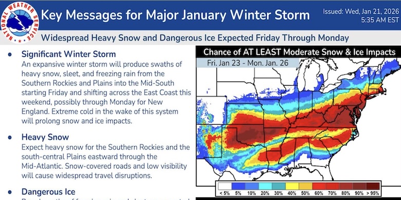
Guidance for the major Winter Storm coming this weekend shifted north a little overnight, further expanding the areas forecast to be impacted Friday through this weekend. Here are the latest key points. An expansive winter storm will produce swaths of heavy snow, sleet, and freezing rain from the Southern Rockies and Plains into the Mid-South starting Friday and shifting across the East Coast this weekend, possibly through Monday for New England. Extreme cold in the wake of this system
will prolong snow and ice impacts. Expect heavy snow for the Southern Rockies and the south-central Plains eastward through the Mid-Atlantic. Snow-covered roads and low visibility will cause widespread travel disruptions. and dangerous ice. In the Mid-Atlantic snow-covered roads and low visibility will cause widespread travel disruptions. Broad swaths of freezing rain and sleet are expected south of the all-snow zone over the Southern Plains, Mid-South, and Carolinas. Treacherous travel conditions, prolonged power outages, and tree damage are likely. Confidence is high that a significant storm will occur, but not on specific details for the storm track, timing, and precipitation amounts. Start preparations now for an impactful and prolonged winter storm and keep up to date with the forecast.