
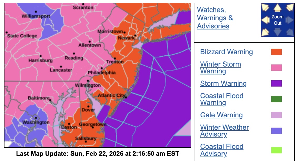
National Weather Service Mount Holly NJ - Sunday, February 22nd at 2:16AM EST - A Winter Storm Warning is in effect From 10 AM Sunday to 6 PM EST Monday.for Camden, Cumberland, Gloucester, Northwestern Burlington and Salem Counties. Blizzard conditions expected. Total snow accumulations between 14 and 20 inches. Winds gusting as high as 45 mph. Travel could be very difficult to impossible. Areas of blowing snow could significantly reduce visibility.
The hazardous conditions could impact the Monday morning and evening commutes. Gusty winds could bring down tree branches.
Parking is PROHIBITED on the following SNOW EMERGENCY Routes and Roadways.
We ask all residents to please park in driveways or other off-street areas whenever possible.
Keeping these routes clear allows Public Works and emergency services to maintain safe travel lanes and respond quickly when needed.
Borough of Merchantville Snow Removal Code
Borough of Merchantville Winter Storm Emergency Numbers.
Governor Mikie Sherrill declared that New Jersey will enter a State of Emergency effective at 12:00 p.m. on Sunday, February 22, 2026 in anticipation
of a severe winter storm expected to cause hazardous weather conditions across the state.
PLEASE NOTE: Follow the Merchantville Police Department and Merchantville Fire Department - Niagara Fire Company for further updates and information.
Thank you for your cooperation and support in keeping Merchantville safe during winter weather. — Borough of Merchantville